Bear Creek:

Not so green

LJ and AMaar, K and Eddy
J in the back

The creek bottom was incredible

This is the damage done by the flooding in 2013 and again this year.
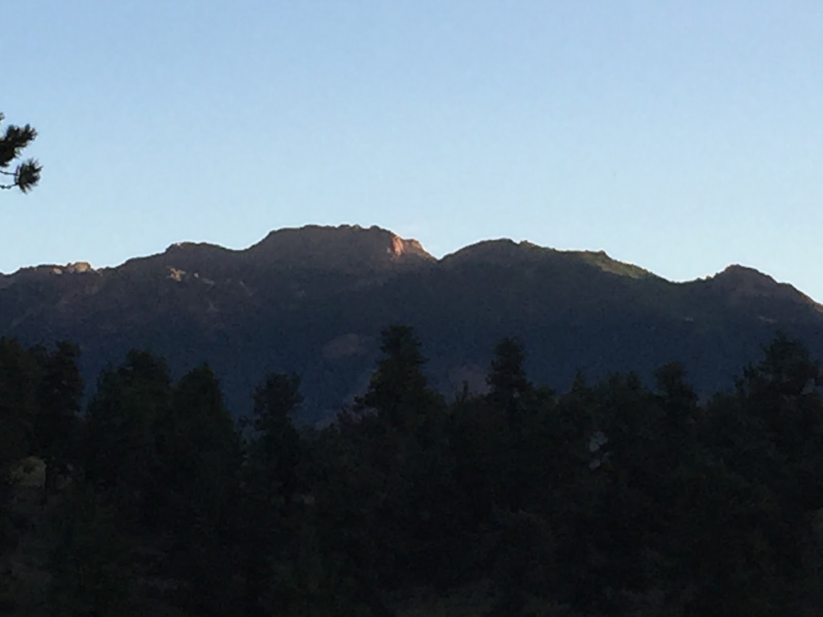
Chatfield:

See the line in the trees, where there are no green limbs below? That was the high water mark this year. At least ten feet up, maybe more like 15.

The water line a little closer, plus the foam that gets on the top of the water when the water is moving quickly, left behind when the water receded.

We stopped to eat a snack and let Ashke graze. There was what we suspect was fresh urine on the side of the tree, compliments of some passing man (too tall on the tree to be blamed on a woman). Ashke ate the bark that the urine was on. Which is how we came to realize that we stopped next to the only tree in the State park that had fresh urine on it.
I have no words.

Flood damage by Plum Creek. The dried mud was six inches deep.
Camping:
We were supposed to drive to Idaho, but instead we went camping. We drove nine and a half hours there and back to camp for fourteen hours. All three of us started having issues with altitude sickness, so we packed up and headed home.

It was so quiet, I didn't sleep. This was the sunrise at 5:45 in the morning.
And half an hour later as I sat outside watching the dogs run themselves silly.

Lily in the early morning sunshine

T in the early morning light.

Indian paintbrush.
Every where.

Panoramic view from the step of the camper.

Skittle and T in the hammock.

T and Lily in the hammock

The meadow.

The watch dogs.

Our dogs are so good. They stay close. They are very protective. They bark.
They run in circles. Dog stuff.

T and the girls.

I didn't make it to the top of the hill. I coped out at the bottom.
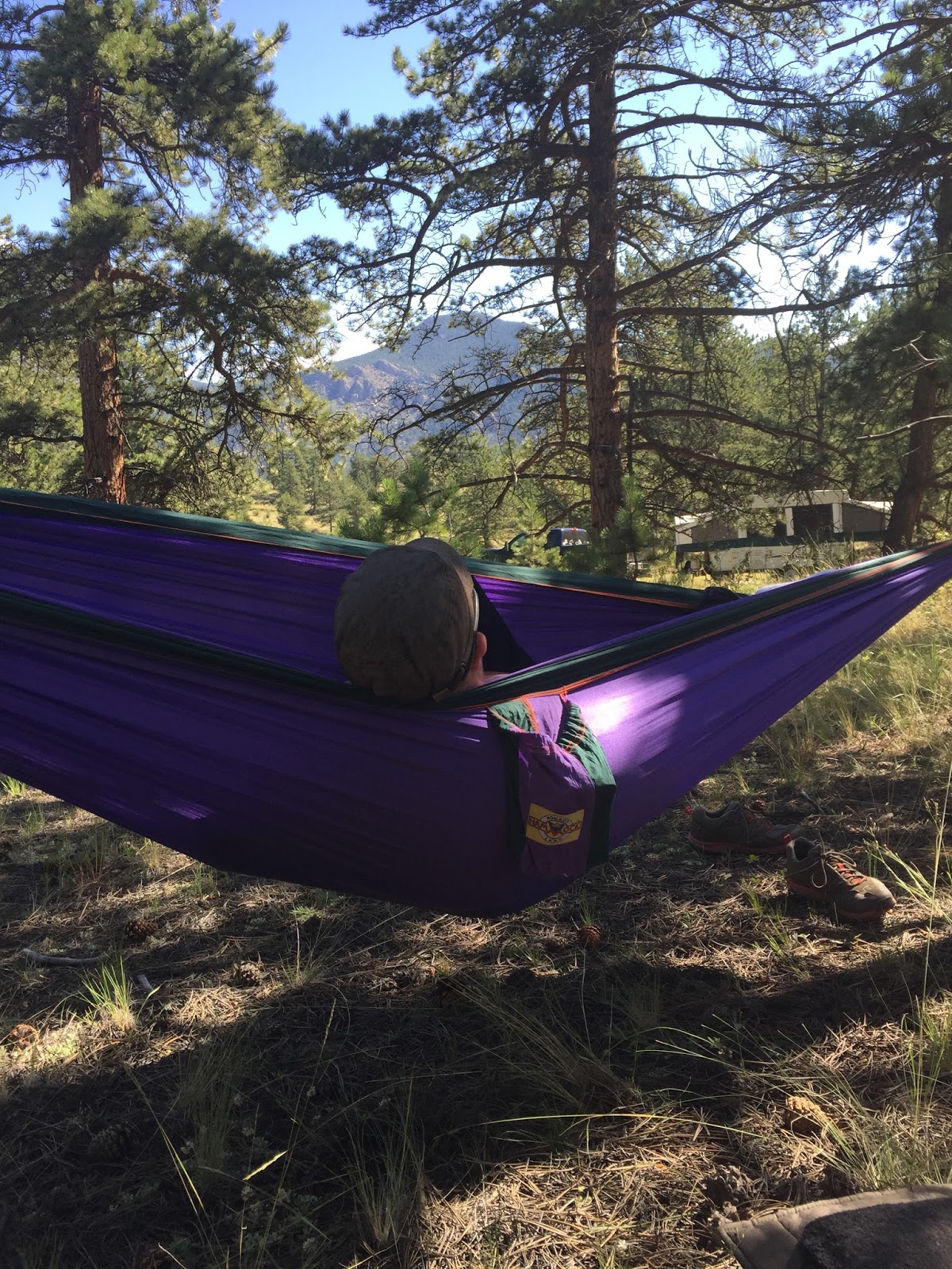
Hanging in the hammock

Dogs in the sunshine.

Picture of a hummingbird buzzing the bright yellow web.

Lily in the hammock with me

Hanging.

Zonked.

Skittle. Hammock. Feet.

Happy boy.
On our hike we found a stock tank made from a huge tractor tire with a steady stream of water from an under ground well keeping it full. Lily couldn't help herself.
She scored a 9.5 for her dismount from the Russian judge.
Everyone else was laughing too hard to vote.

Fourteen hours after we pulled in, we headed out. Why?
No meat for dinner, no extra water (forgot the tanks at home), two tired, footsore dogs and three altitude sick humans.

The ride home.

Too tired to stand up but really wants her nose out the window.
Cherry Creek State Park:
This was a first for us. It will also be a last for us. The park is not horse friendly.
We got a map when we first got there, studied the trails intently, marked the ones that were off limits (wetlands and swim beach) and headed out on 12 mile path. Both horses were very up and offered a huge trot and then some canter right off the bat. K was saying later that she hates the big trot because Eddy's legs are so short it gets choppy for her. Ashke was like riding a surging wave so I like the big trot. Next time, we either canter or we trot slower.

We think, although I am still not sure, that the designated parking area for equestrians was a green field, but it wasn't marked, so we aren't sure.
When we got to the wetlands, next to Cherry Creek, the 12 mile path (designated as a trail for horses) went into the off leash dog area. We were astounded. We checked the map. Sure enough, the trail went into the off leash dog area. There was no other way around. We headed in. The trail went in and then went out a short distance later, making a small loop. There were a couple of dogs that decided we looked like fun to chase, so Ashke and I spent our time between Eddy and the wolves. (Ashke will pin his ears and go after a dog that gets too close. Eddy will run. So Ashke and I hunted wolves and kept Eddy safe.) We were maybe a hundred yards from the out fence marker when we were accosted by a cranky Park Ranger who really should have taken her prozaic that morning.
First, I understand that taking our horses into the dog park was dangerous. We understood what the risks were, but I also understood that Ashke was not going to do anything but go after the dogs if they got too close. Second, the damn map told us to go through there and the Ranger at the front gate told us we should ride that trail. Third, don't fucking assume that we deliberately chose to violate Park policy and listen the first time when I tell you we have never ridden at Cherry Creek before and we certainly don't keep our horses at the Cherry Creek stables. Fourth, why turn us around and walk us back to the original entrance when the second entrance out was closer? And finally, I don't need to hear about how someone got thrown and ended up doing a "Christopher Reeves". It's not classy.
Thank you for pointing out the correct trail. Can I just say how very badly the trails there suck?

The correct path.

At the end of that very long path was the stables. I was not impressed.

The horse trail on the South east end of the Park.

We stopped for lunch and then continued on to the Cherry Creek Trail.
Not a lot of trees.

We played hopscotch with who was in the lead.
Neither of us was happy with the way our horses acted in the back of the other.

His big trot.

Coming up to J.

The Eds. Cantering.

Coming up to the road that cuts through the wetlands.
So the trail we were on was an old railroad bed (rails to trails) that was really nice to ride on, but it led straight to the shooting range and the closer we got the more anxious Eds got. So we moved back onto the sidewalk. By the time we got to the road through the wetlands, I was done. We asked a Park Ranger if it was okay for us to travel back alongside the road and were given permission. We took it and were back to the trailer in fifteen minutes.
We will not want to ride there again. No one on their bikes slowed down to check if the horses were okay, the cars were driving by super fast, and the trails sucked.
But still, it was a ride.
This may be a really silly question, but I live at sea level so I don't know. Aren't you already accustomed to the altitude living in CO? How much elevation gain was there at camp to notice the difference?
ReplyDeleteThe experts say that traveling from a lower altitude to over 8000 ft can trigger it. We routinely came in Wyoming at an altitude of 8000 ft and never have a problem there. Tarryall, where we were camping, I figure was over 9000 ft, which is the altitude that triggers my symptoms. This is not the first time we have gone from Vedauwoo to Tarryall and had altitude issues. T brought a friend camping with us three or so years ago and everyone was fine at Vedauwoo. We drove from there to Tarryall and T's friend started throwing up. We had to break camp and head back to Denver, since there is nothing you can do for it.
DeleteAll three of us had symptoms this time.
And we live at 5200 ft, but I guess there are people who acclimate to the oxygen level here who can experience Altitude sickness when they travel to the mountains. I've always had issues above 9000 feet and have to be careful to limit my exertion.
Loved all of the pictures!
ReplyDeleteIt really sounds like the sole purpose of Cherry Hills' horse trails is to get riders and/or their horses killed! First they take riders through the off leash dog park, and then towards the shooting range??? What the fuck!! I'm glad you all made it out of there safely.
I know. Right?!! The one park ranger we talked with (and J pointed out the discrepancy with the map trail to him) made a comment about how not a lot of people ride their horses there. And now we know.
Delete